The drought and the flood on the Upper Ouse
Posted: Thu May 03, 2012 7:30 pm
Sunday March 11th 2012 and here are a couple of photos of the Upper Ouse betweeen Milton Keynes and Buckingham
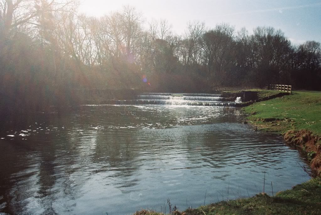
First one is just a hundred yards upstream of Thornton Bridge facing upstream at Thornton weir:
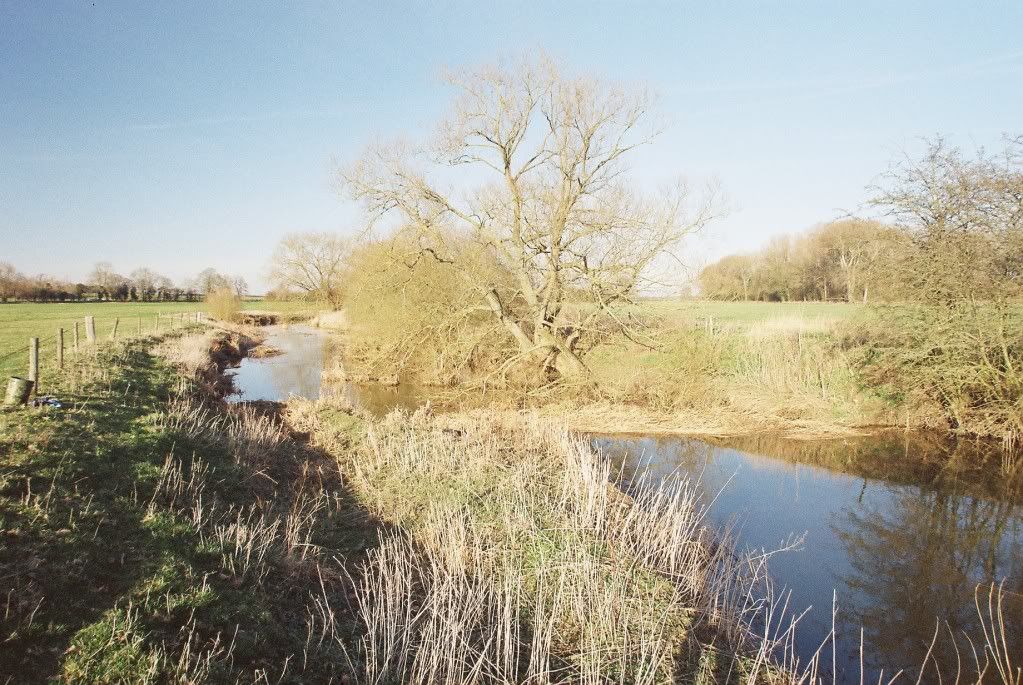
The second one is just a couple of hundred yards downsteam from Thornton bridge on the stretch still called 'Walkers'.
Note just how low the level of the river is for mid March:
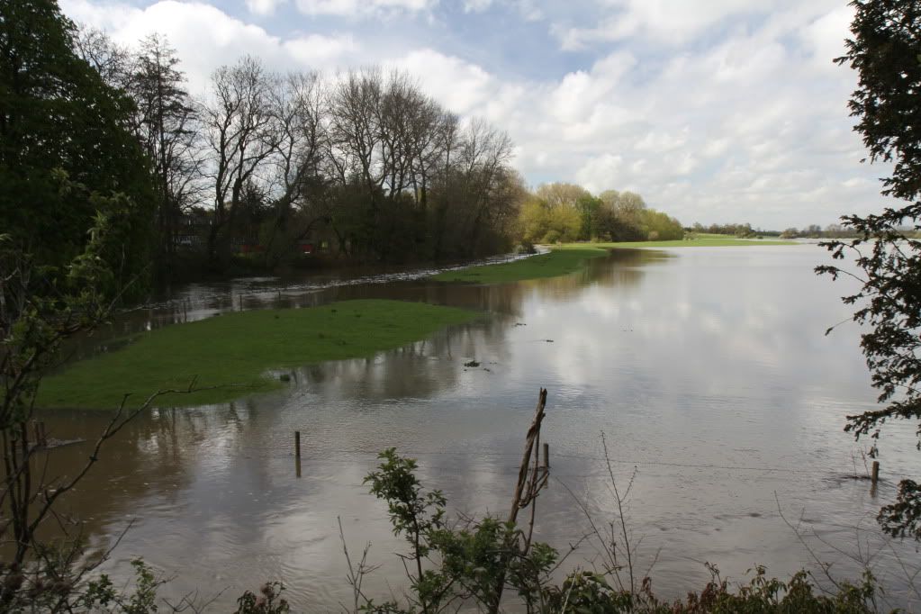
Now roll the date forward to Monday April 30th 2012 - just seven weeks later- It is day 26 of the hosepipe ban in this region.
It has rained almost every day since the hosepipe ban started, and the previous three days prior to the 30th April gave us nearly 3 inches of rain in this area. (Therefore hosepipe bans are highly effective! - QED - )
)
However on Monday 30th April there was a temporary break in the weather - the rain stopped, the sun came out - all day, the temperatures rose, and as I have recently taken early retirement, I decided to go fishing (posting about my fishing session will appear shortly on my personal fishing diary section), but not to miss a good photographic opportunity I decided to first of all venture out to the Upper Ouse and take a few photos of the river.
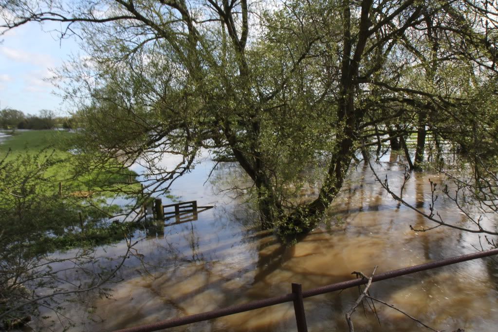
First two are taken from Thornton bridge facing upstream towards Thornton weir ( to compare with the first photo from March 11th I posted). Just in case its not clear whgere the river actually is, its the narrow stretch on the left of the photo.
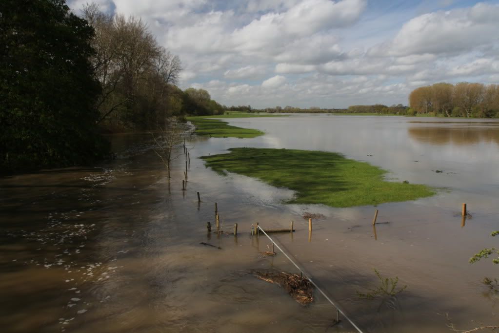
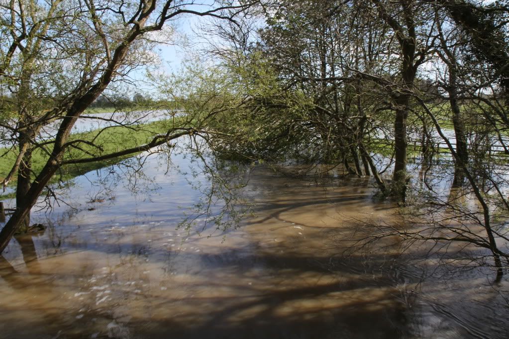
These two are also taken from Thornton Bridge facing downstream - 'Walkers' stretch ( to compare with the second photo from March 11th):
Well that should have finally flushed out all the debris and rubbish accumulated for the last 18 months of drought conditions !
First one is just a hundred yards upstream of Thornton Bridge facing upstream at Thornton weir:
The second one is just a couple of hundred yards downsteam from Thornton bridge on the stretch still called 'Walkers'.
Note just how low the level of the river is for mid March:
Now roll the date forward to Monday April 30th 2012 - just seven weeks later- It is day 26 of the hosepipe ban in this region.
It has rained almost every day since the hosepipe ban started, and the previous three days prior to the 30th April gave us nearly 3 inches of rain in this area. (Therefore hosepipe bans are highly effective! - QED -
However on Monday 30th April there was a temporary break in the weather - the rain stopped, the sun came out - all day, the temperatures rose, and as I have recently taken early retirement, I decided to go fishing (posting about my fishing session will appear shortly on my personal fishing diary section), but not to miss a good photographic opportunity I decided to first of all venture out to the Upper Ouse and take a few photos of the river.
First two are taken from Thornton bridge facing upstream towards Thornton weir ( to compare with the first photo from March 11th I posted). Just in case its not clear whgere the river actually is, its the narrow stretch on the left of the photo.
These two are also taken from Thornton Bridge facing downstream - 'Walkers' stretch ( to compare with the second photo from March 11th):
Well that should have finally flushed out all the debris and rubbish accumulated for the last 18 months of drought conditions !


